9:00 AM Thursday
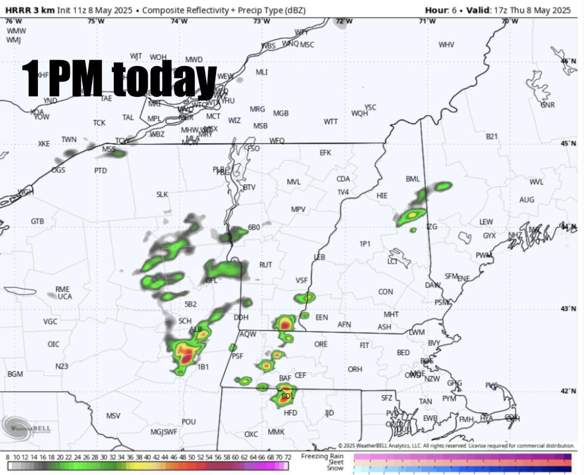
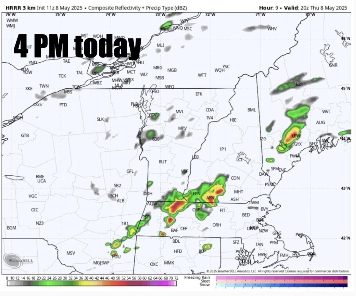
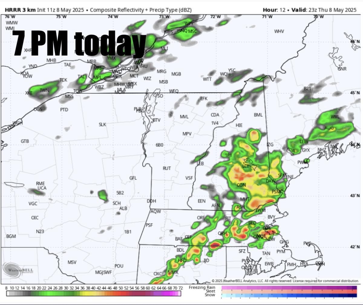
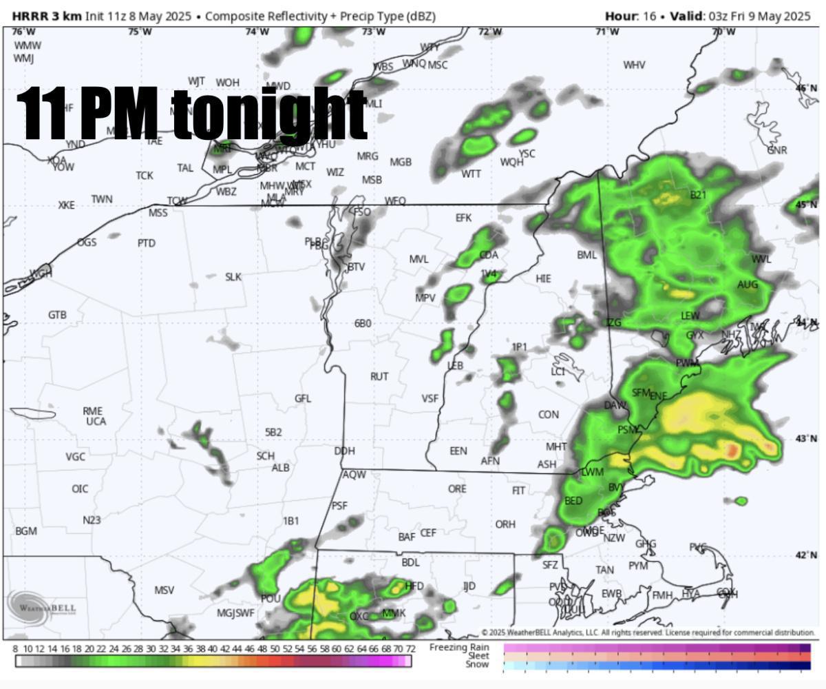
Good Thursday morning. Soak in the sunshine today because we have widespread rain on the way tonight into Friday and through much of Saturday for many. Highs in the 50s across Northern New England today with highs in the upper 60s, low 70s across Southern New England. A few downpours and storms are expected to develop this afternoon through the evening across the region especially across SNE and may drop a quick inch to an inch and a half of rain in localized areas before the main batch of rain Friday into much of Saturday. Future radar below shows those scattered downpours and storms this afternoon, evening. Non-Severe storms expected but some lightning possible and some localized pockets of street flooding likely.
Widespread rain Friday, Saturday
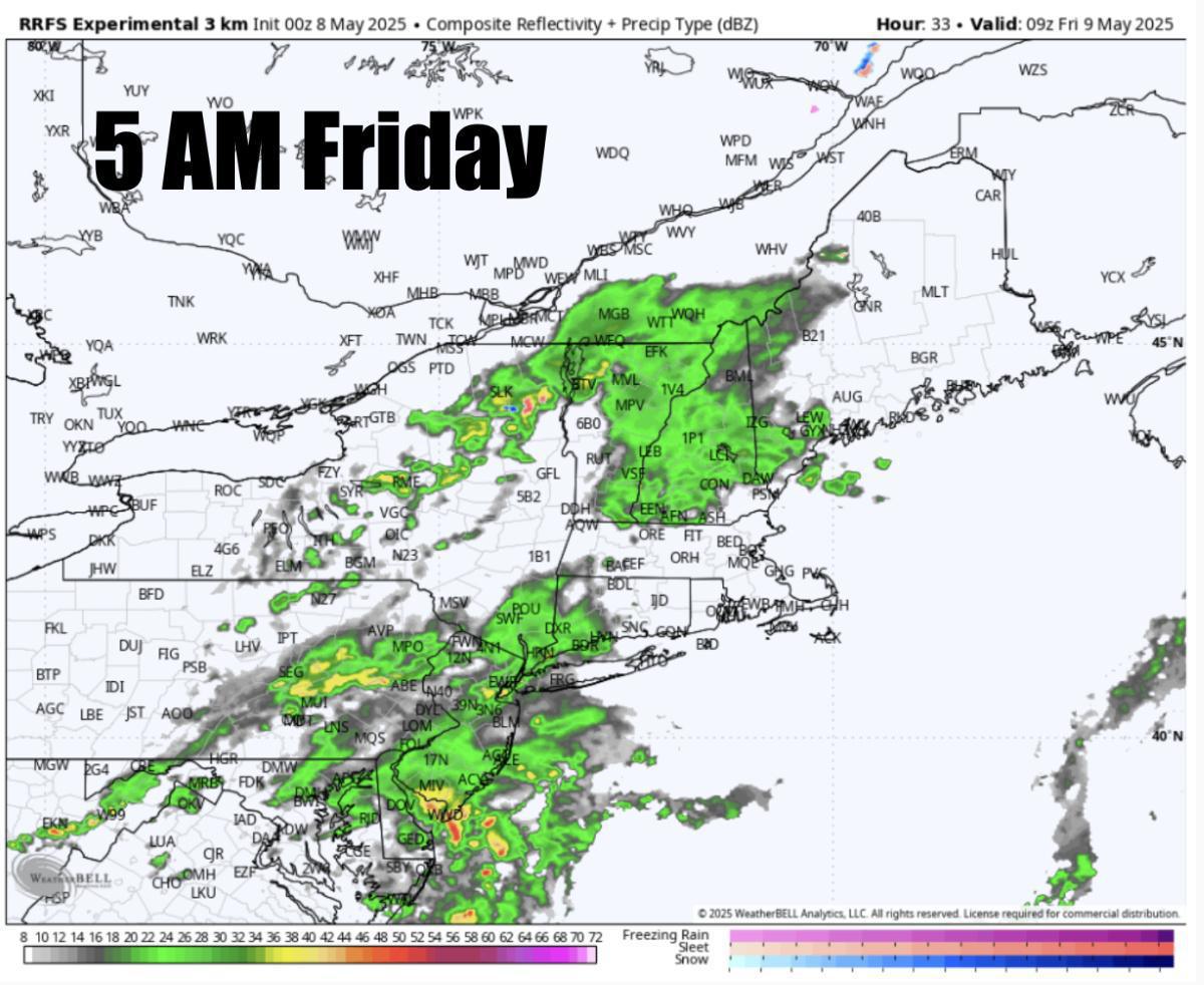
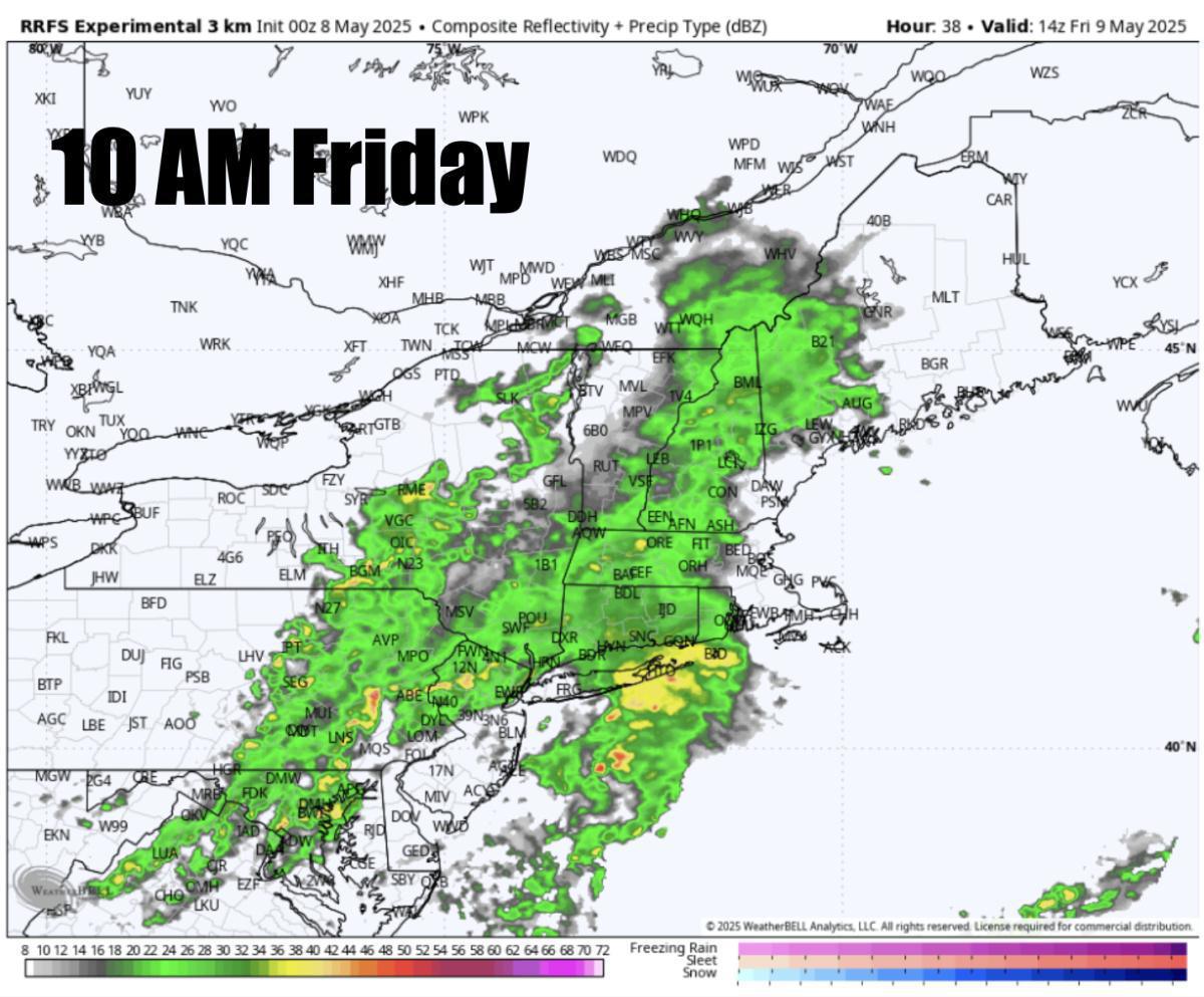
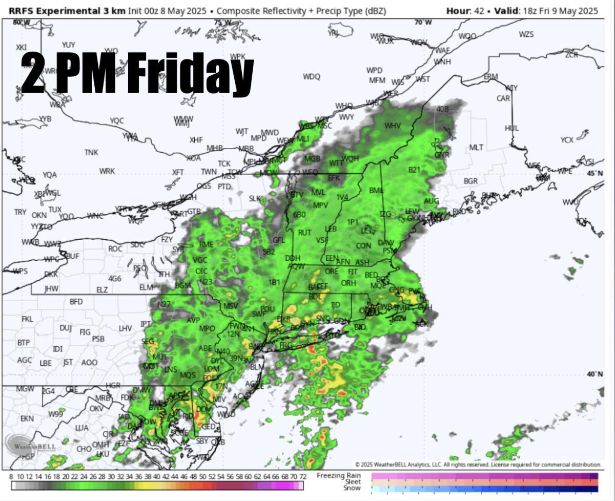
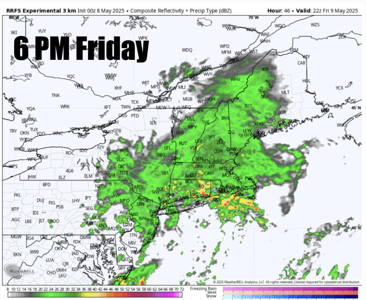
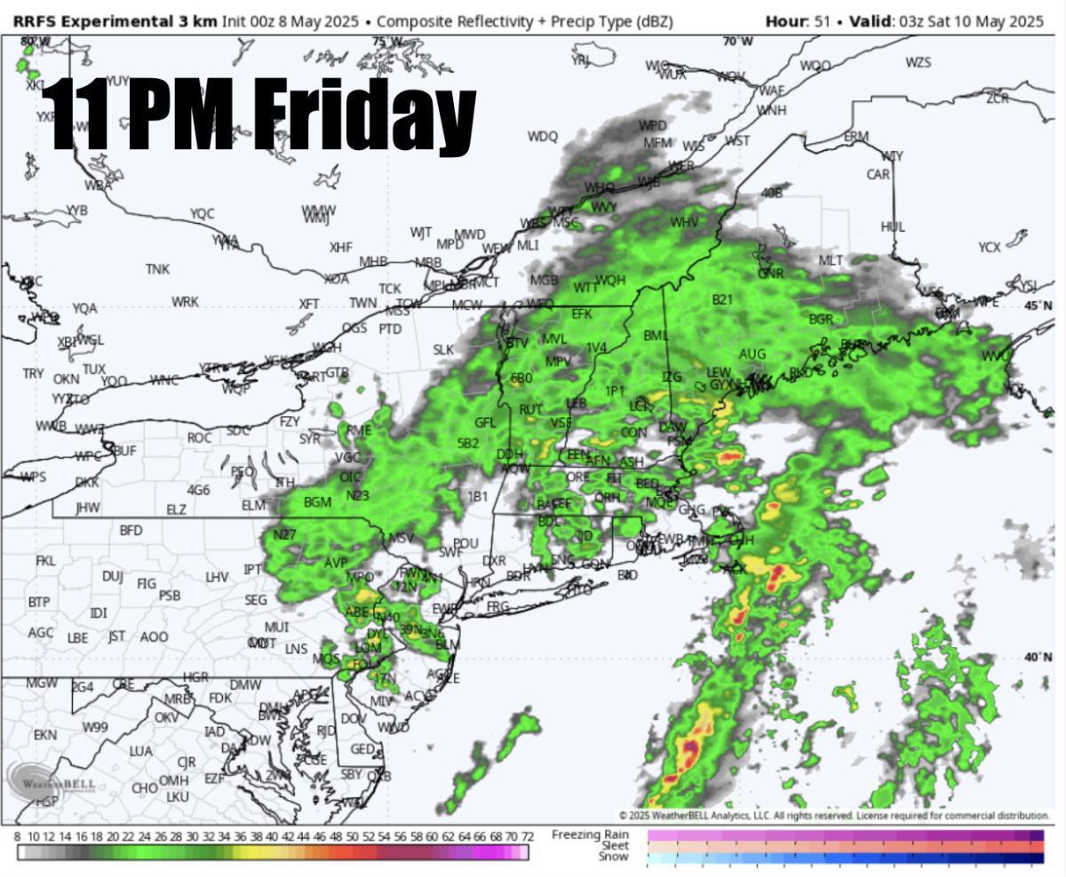
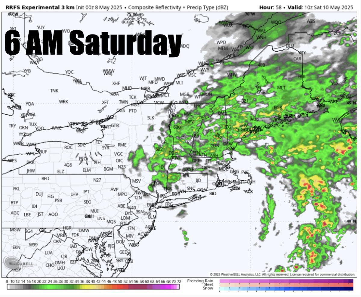
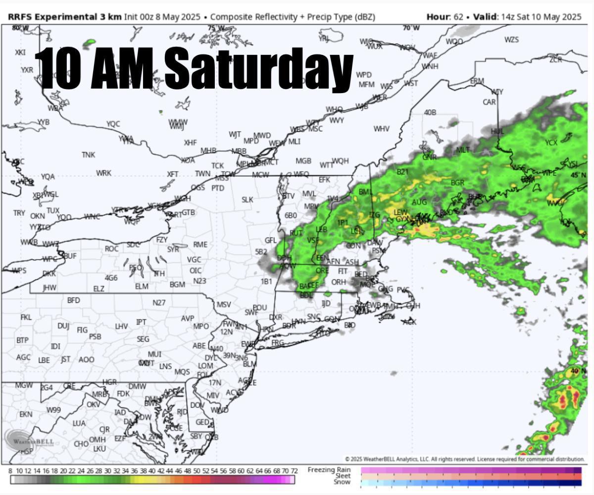
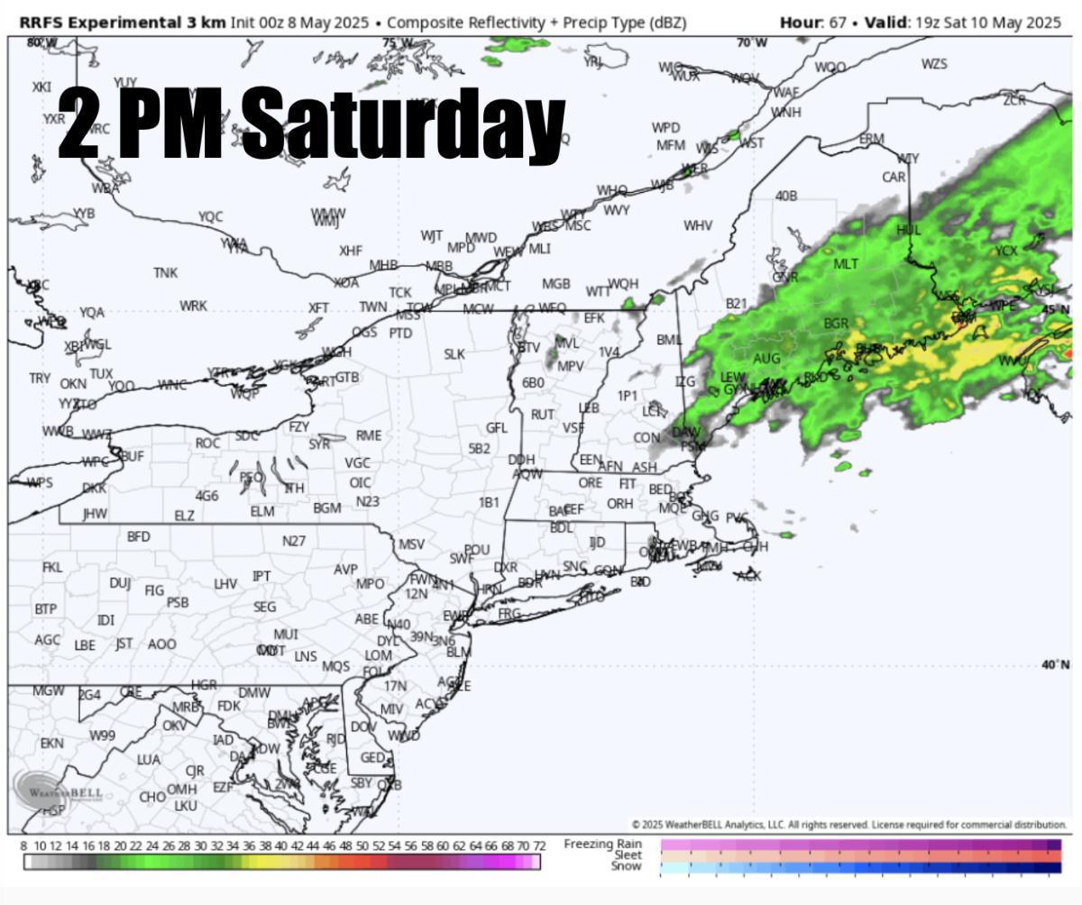
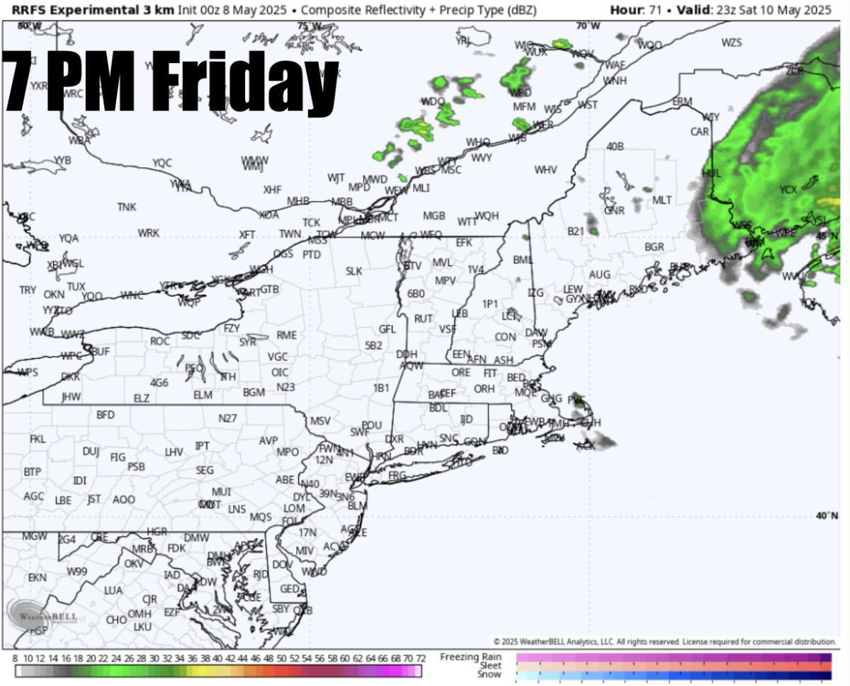
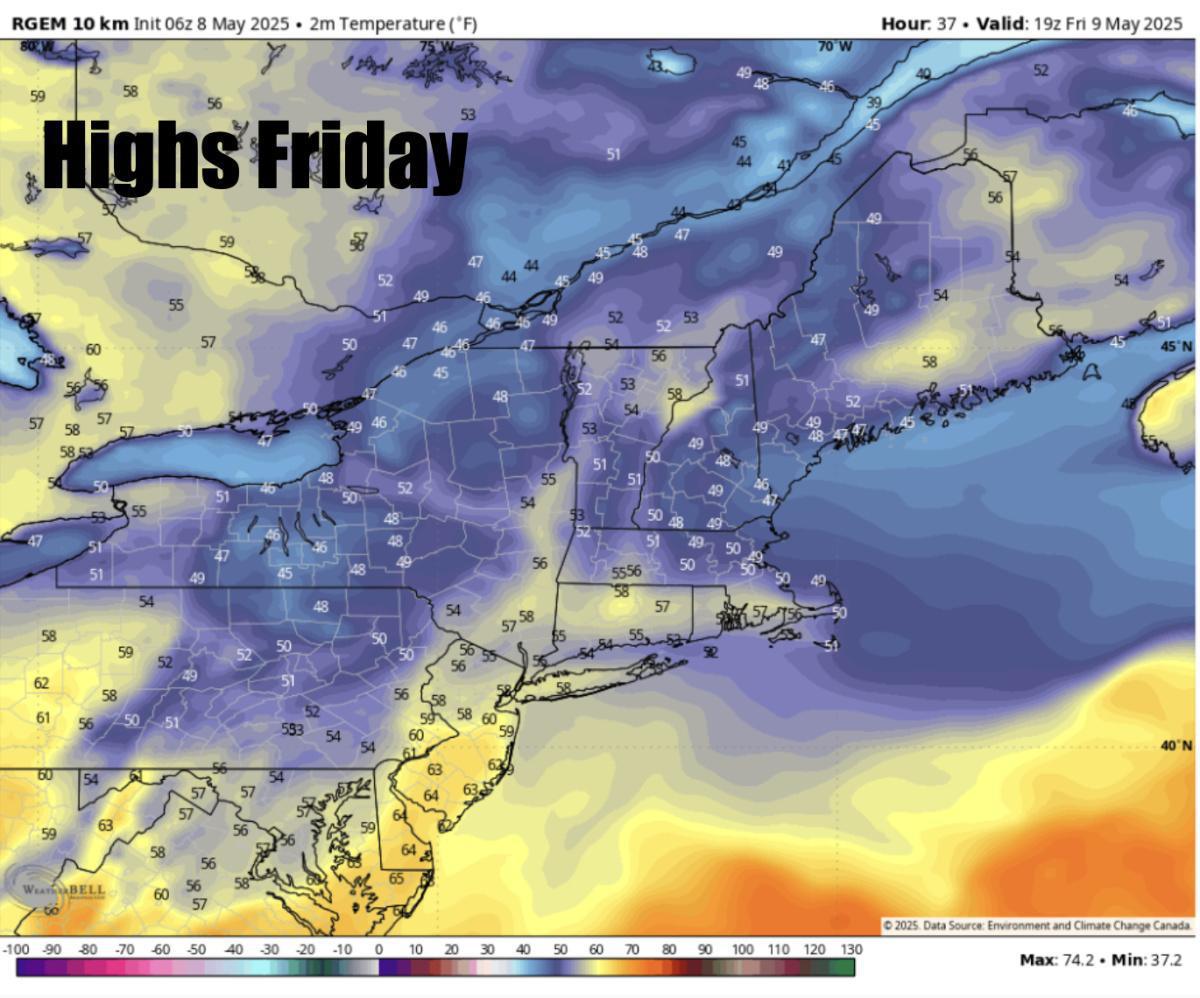
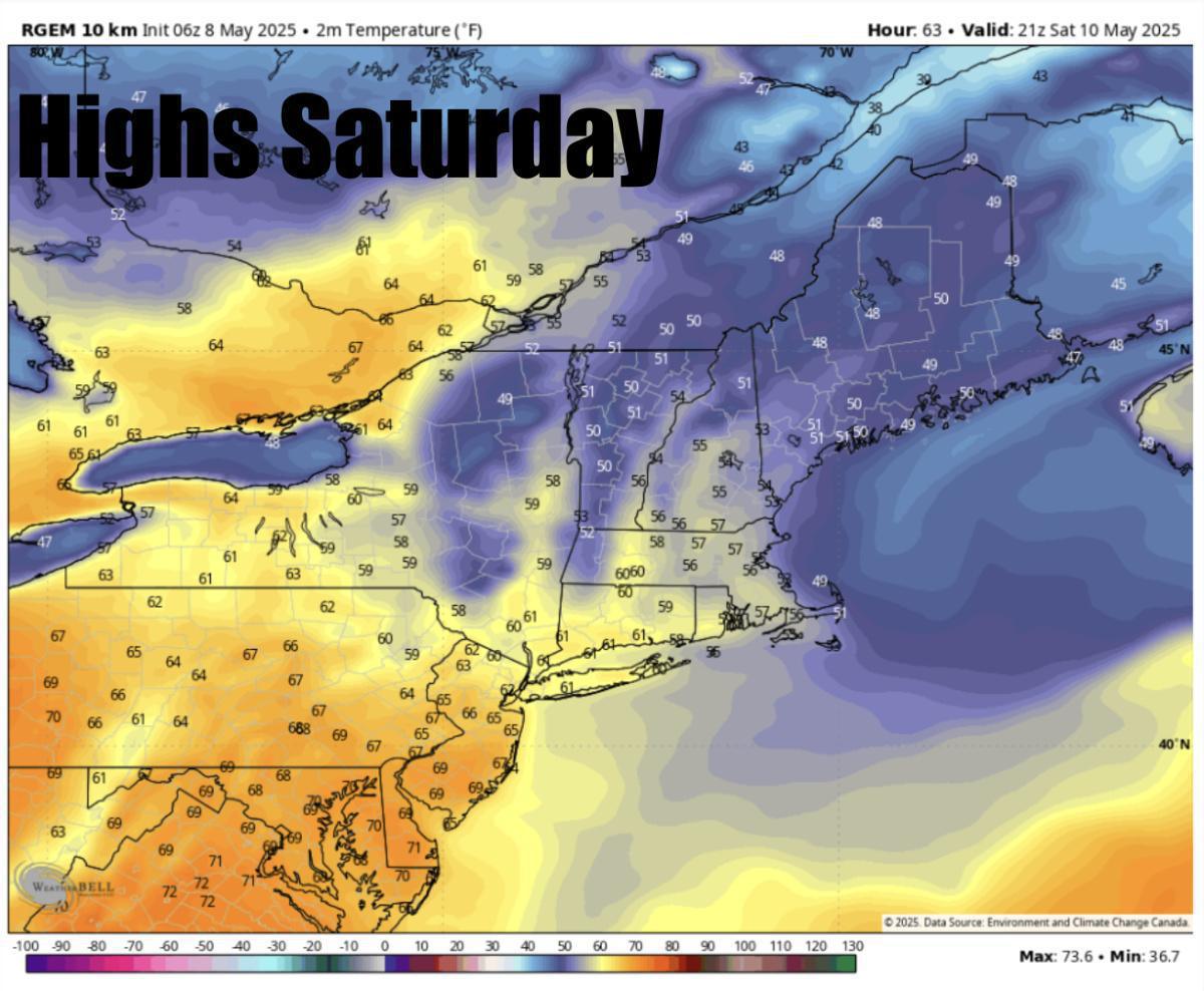
Widespread rain is expected to increase early Friday morning from south to north. Rain is expected to continue into Friday night through much of Saturday. Widespread heavy downpours! Widespread 2-3" of rain can be expected with some pockets of 4". Say goodbye to our drought! The heaviest rain by Saturday morning is mostly confined to Northern New England but still remaining dreary across SNE during the morning on Saturday before some breaks of sunshine Saturday afternoon across SNE. Rain hangs around across NNE Saturday afternoon. This specific model may be a bit too quick to move the rain out by 2-3 PM Saturday as some showers will likely still be hanging around across NNE. (See future radar below) Highs Friday stuck in the upper 40s and low-mid 50s! 50s expected on Saturday.
MUCH NICER WEATHER is expected Sunday through at least Tuesday with plenty of sunshine and temps likely making it into the 70s across the region with 60s, low 70s Sunday. Few 80s possible next week but a lot of rain to get through first! Stay tuned for updates
-Henry's Weather Channel


