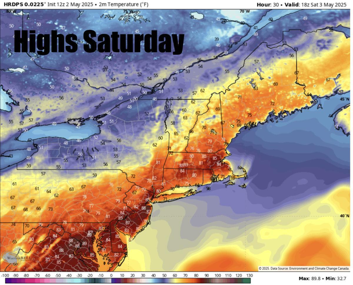
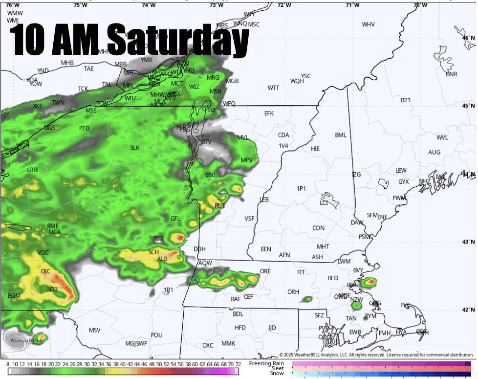
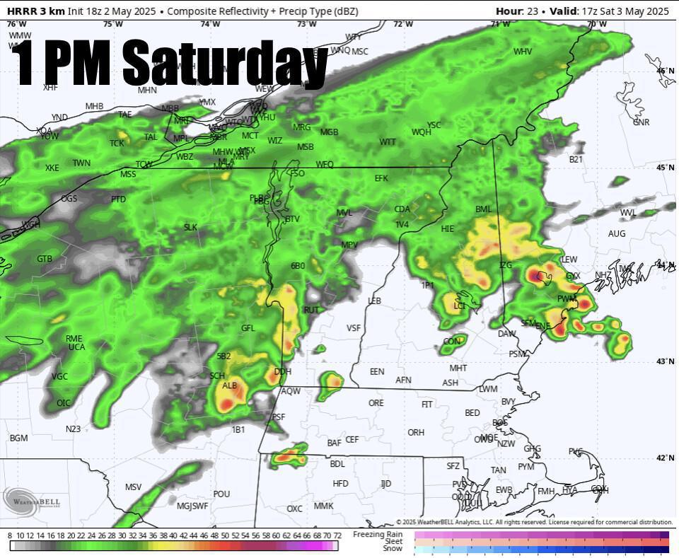
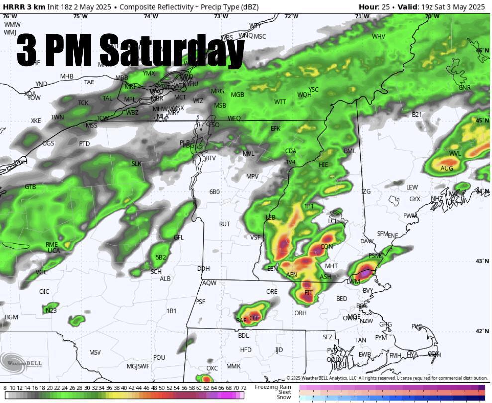
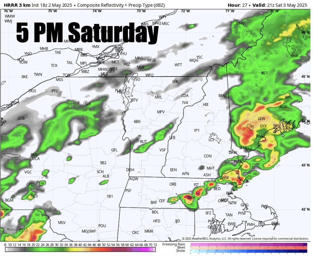
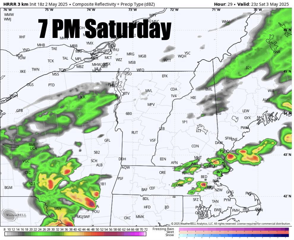
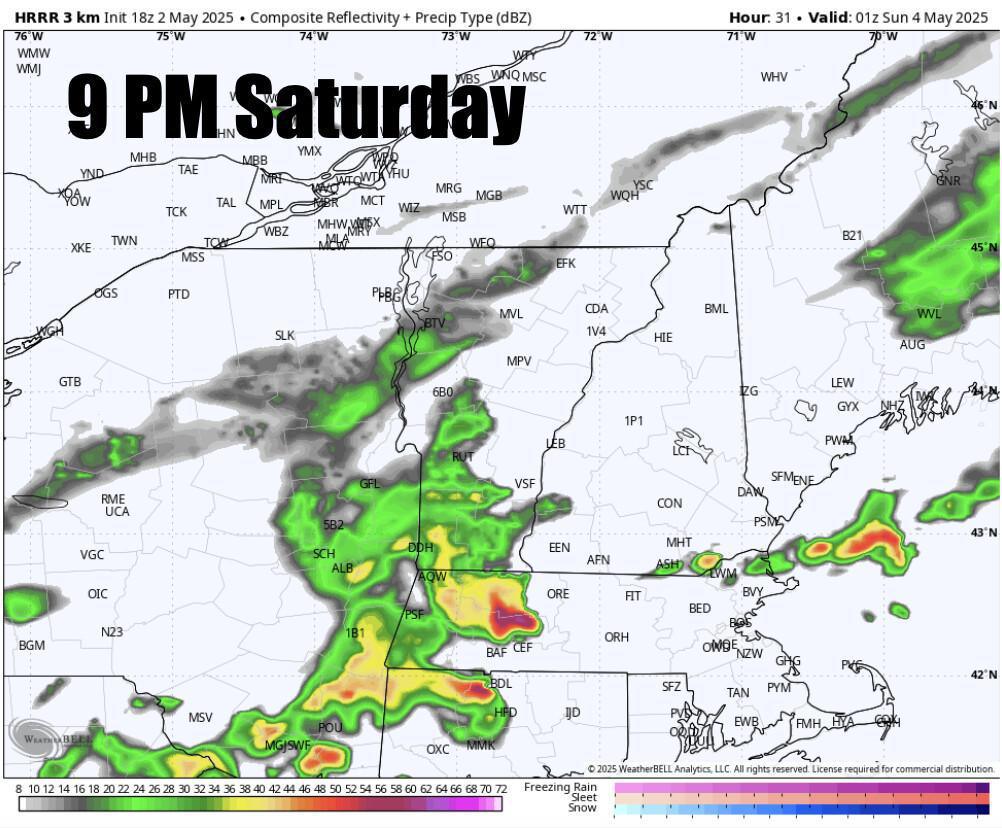
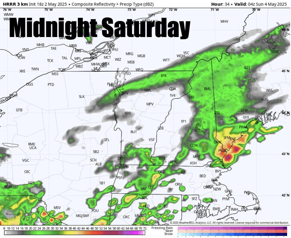
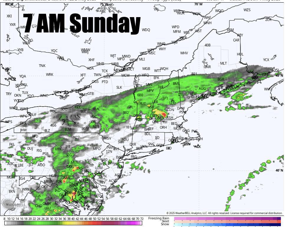
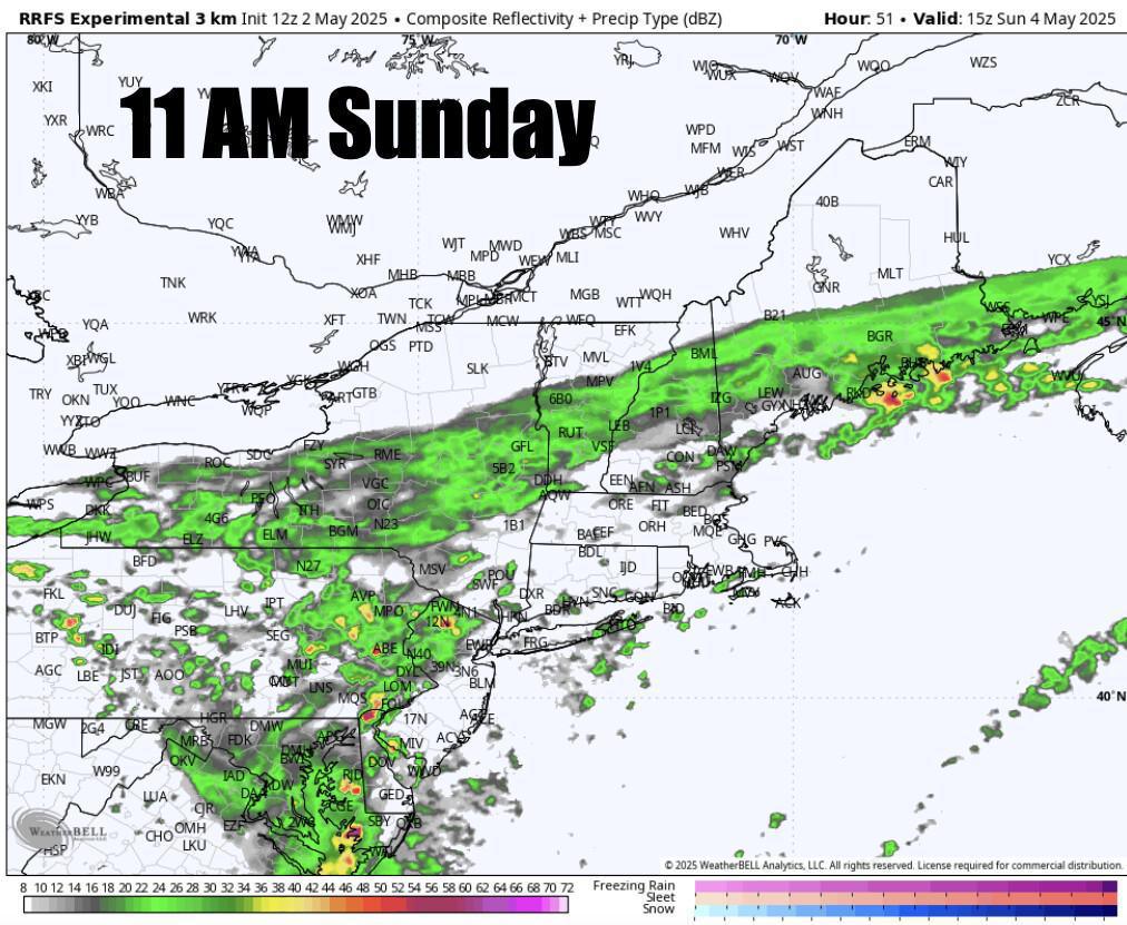
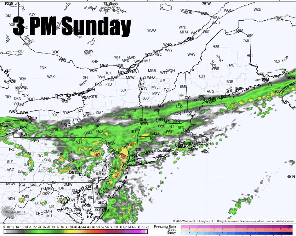
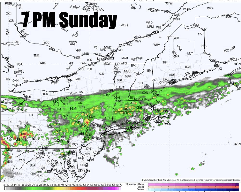
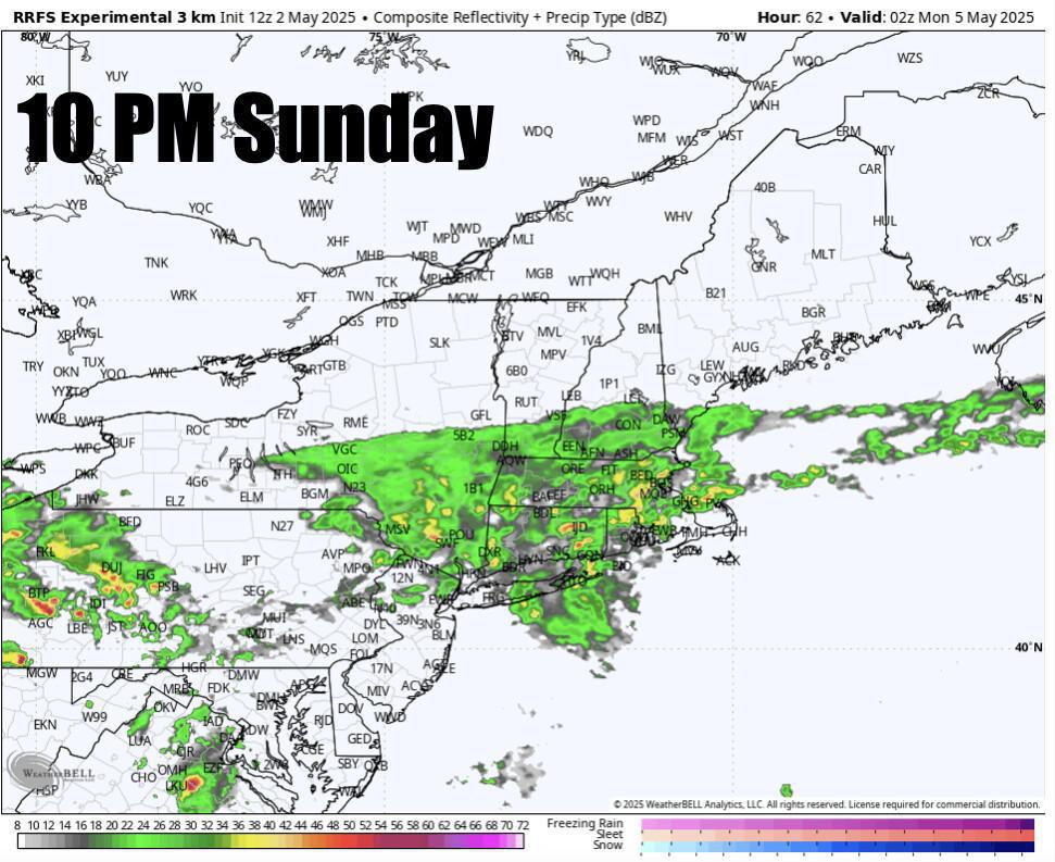
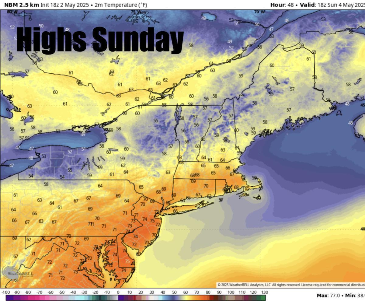
Good afternoon. This weekend will be unsettled but not a washout! Severe storms are expected for Saturday with the coverage area being more expansive than the storms today. Highs tomorrow rising into the upper 70s to low 80s across SNE. 60s expected for NNE. The problem is our warmfront only makes it up to about central New England. Along that front will form a boundry where a line of storms will likely bubble up across Eastern NY into Central, Southern VT, through NH, across SNE into Maine between 2 pm through 10 PM although i think the bulk of the storm activity will be between 2-6 PM. Just some showers for far NNE. The morning starts off sunny and humid with some light showers across NNE. The main threats tomorrow with these storms will be damaging winds of 60 MPH with small hail and localized flash flooding. Remember, not everyone will see a severe storm and don't focus on the exact placement of these storms on the future radar. You will need to keep a close eye on the sky tomorrow afternoon through the late evening hours. Tomorrow night our severe weather threat diminishes after 10 PM with some leftover showers through the night but no severe storms expected after 10 PM. Sunday will feature a band of rain across NNE Sunday but generally light. Sunday afternoon that front drops a bit south as those showers will likely become scattered across NNE and more confined across SNE with more of a steady rain especially by the late afternoon,evening. Can't rule out a few breaks of sunshine. Highs Sunday in the 50s, 60s. Near 70 possible across SNE. Monday through Wednesday look dreary! Rain showers likely around but again they look scattered so it will not be raining every minute. Still a bit of uncertainty so we will keep you updated! Stay weather aware on Saturday with those expected storms!
-Henry's Weather Channel


