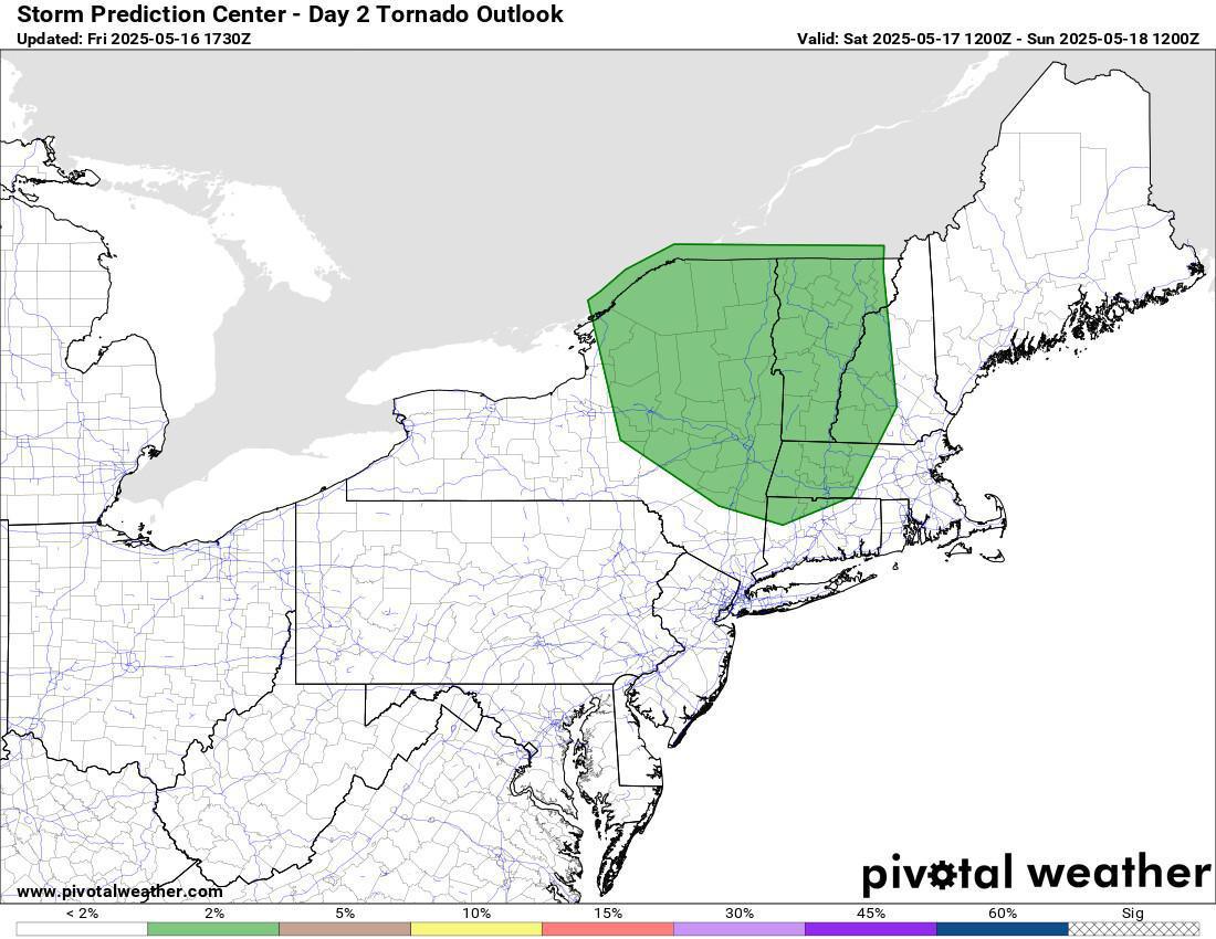
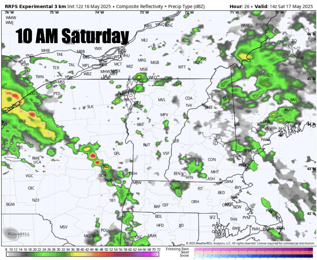
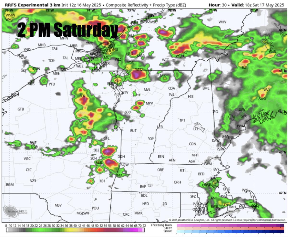
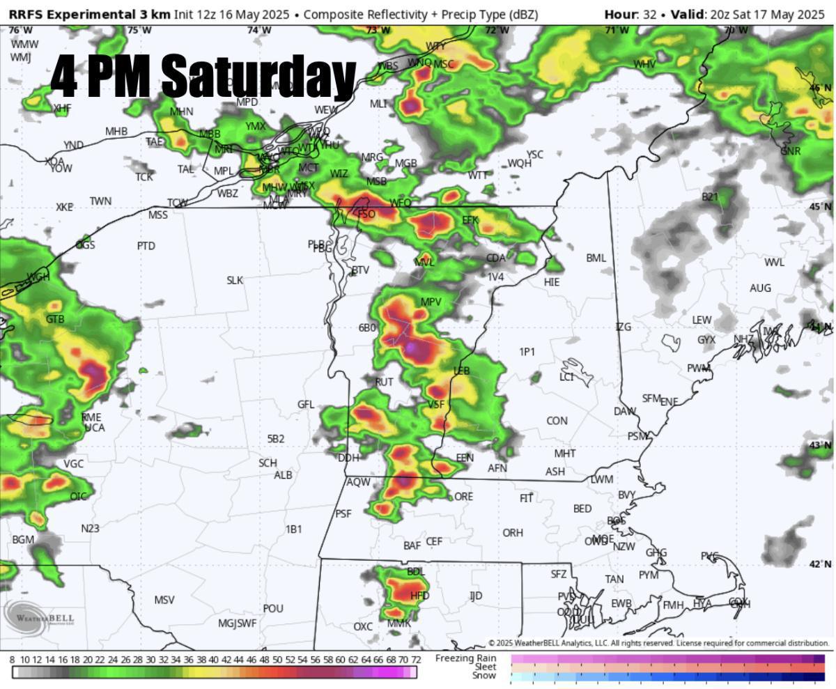
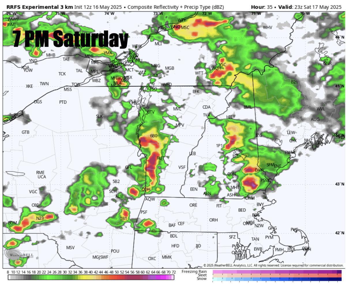
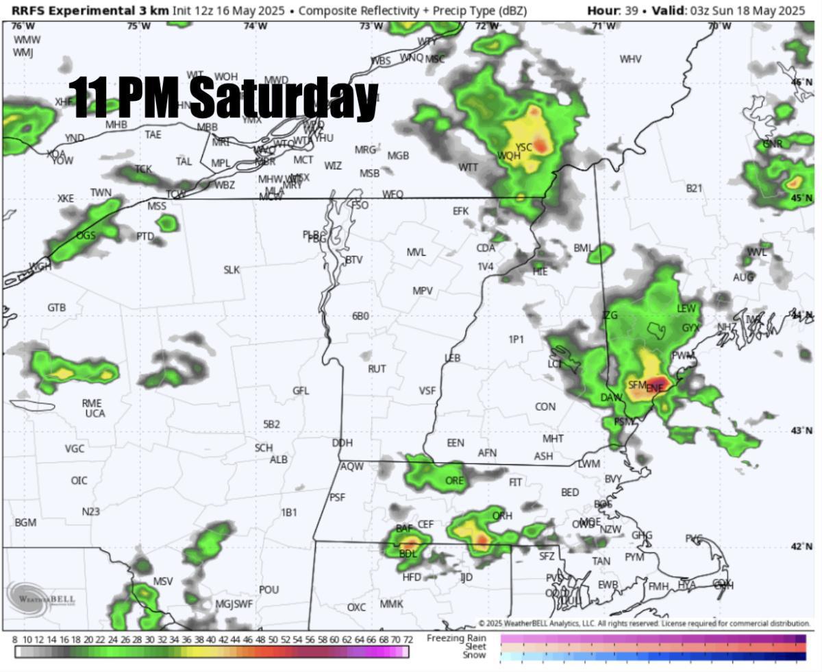
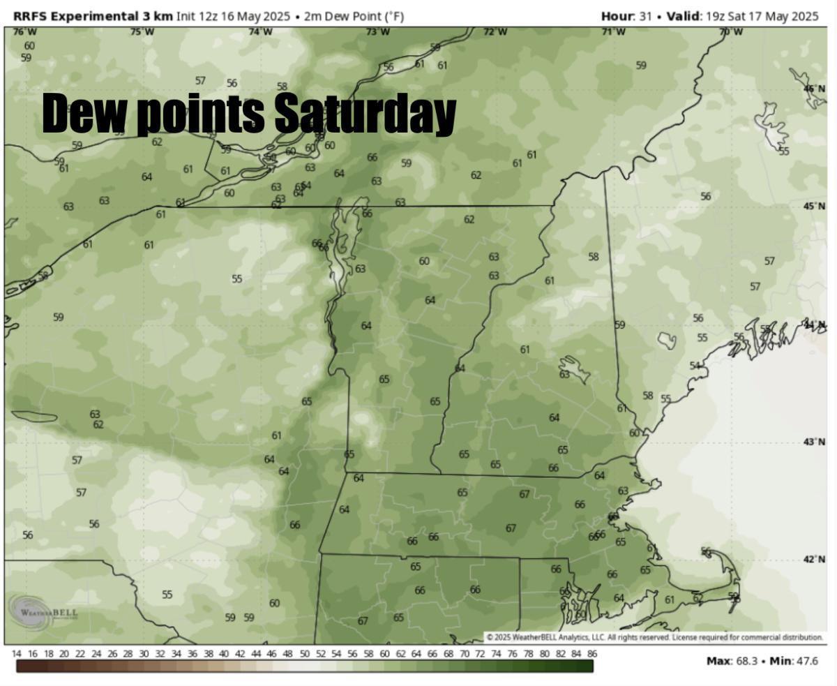
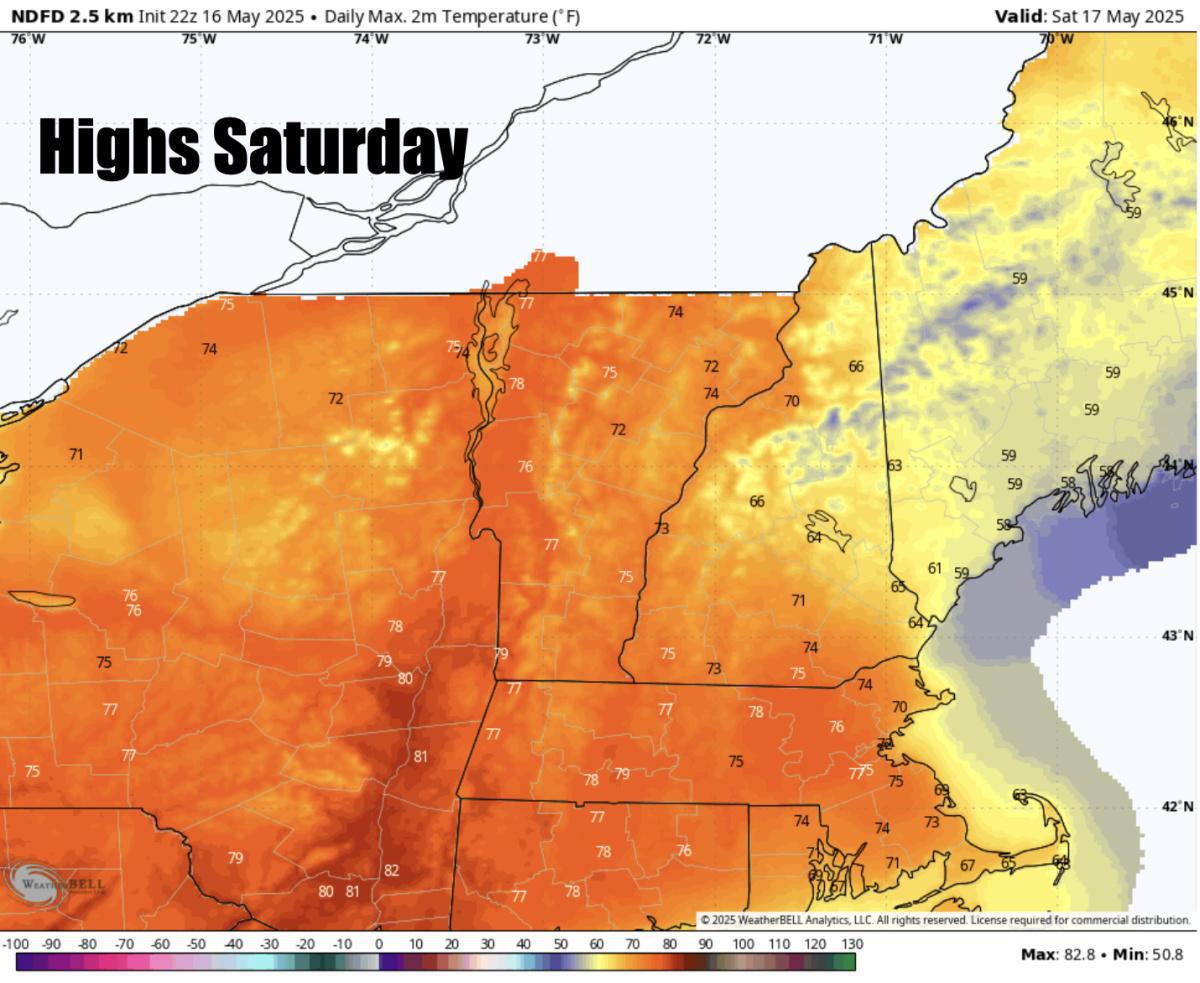
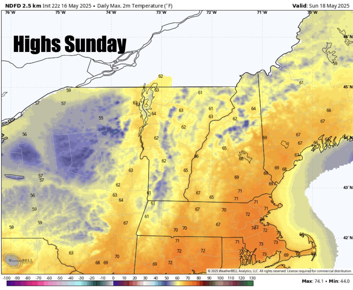
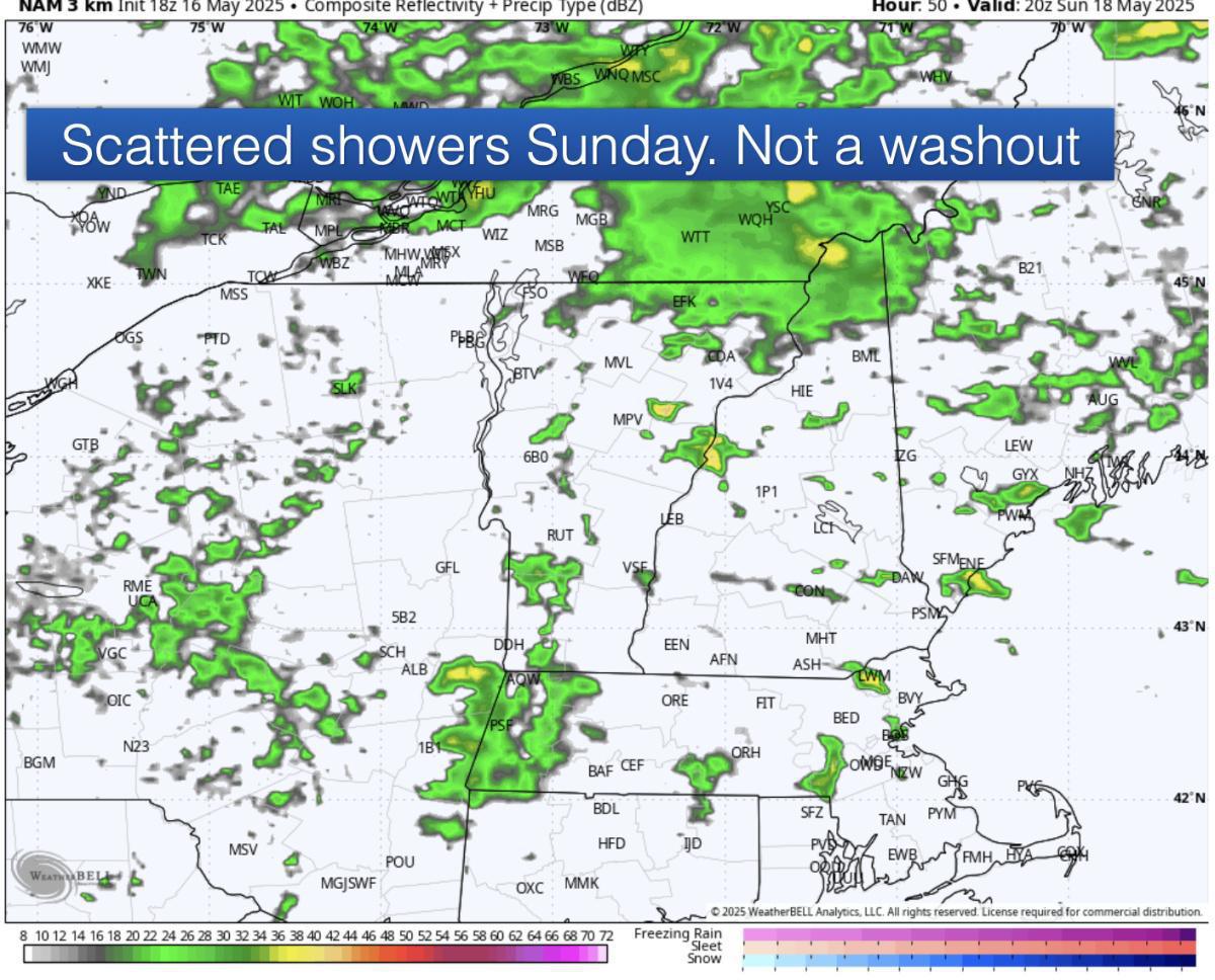
Good evening everyone. The weekend forecast is here! A bit of an unsettled weekend ahead before a chilly week next week! Scattered severe thunderstorms are expected on Saturday across parts of the region. The Storm Prediction Center has placed Upstate NY into through Vermont into Western NH and Western MA into a SLIGHT RISK (Level 2-5) with a 2% tornado risk across that area for tomorrow afternoon, evening! Morning convection may limit this potential but if morning showers, downpours move out by the late morning and sunshine pops out in Western NE then a few cells could very well produce damaging winds and hail with an isolated 2% chance for a tornado. The highest threat in Western New England but some storms may make it to Eastern New England by the late afternoon. Mostly cloudy skies expected for the majority of the day with some breaks of sunshine expected in between those storms which will fuel the atmopshere! Keep a very close eye on the sky especially out that way on Saturday! Threat diminishes after 8 PM Saturday. Highs tomorrow only in the upper 50s across Maine and the 70s to near 80 across much of the rest of New England into NY. Dew points in the 60s to near 70 tomorrow across much of the region which will help fuel those storms! Sunday will feature highs in the upper 60s, low 70s across Eastern NE and upper 50s, low 60s across NNE. Much cooler compared to Saturday. Dew points upper 40s, low 50s. Much less humid as that front swings through tomorrow. Scattered showers and downpours expected Sunday but not a washout! Next week will be chilly! Stay tuned for updates and keep a close eye on the sky tomorrow!
Weekend forecast for May 17th-18th. Severe storms on Saturday!
Written on 05/17/2025
Henry Swenson


